PRÉPARER MA VISITE > Useful informations > Access
Map and access
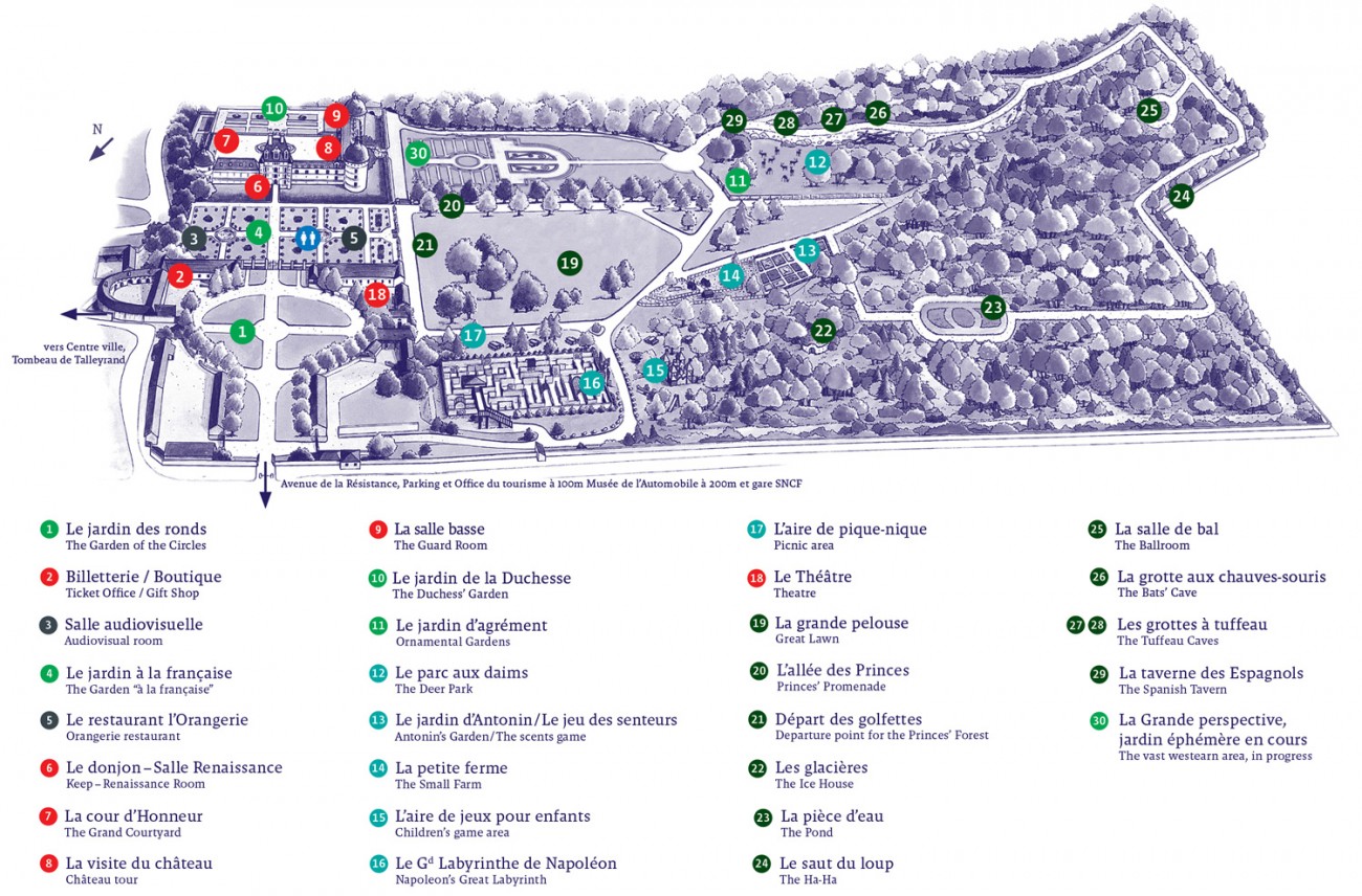
Catherine Pivert / www.plan-illustre.com
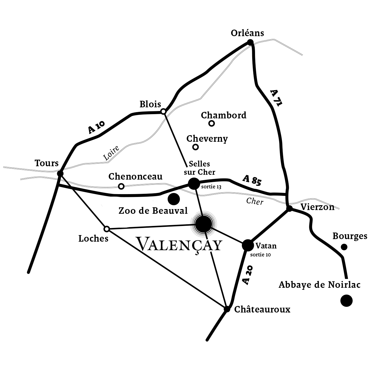
Access
A85: exit 13 (from Tours) and exit 14 (from Paris) A20: exit 10
GPS coordinates: 47.159812900, 1.561919100
Free parking outside the château
Tourist Office car park, car parks on Avenue de la Résistance and Route de Loches, fairground.
Free car park for buses located 100m
from the château.
Bike shed located by the ticket office entrance
Train
Reservations and tickets via SNCF
Access to the castle from Valençay station on foot (10 min)